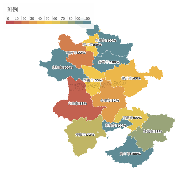
做简单的地图展示,不需要专业的GIS组件,使用DevExpress即可完成,以加载Shp地图文件为例:
private void LoadShp(string path){ //创建SHP数据源 ShapefileDataAdapter dataAdapter = new ShapefileDataAdapter { FileUri = new Uri(path), SourceCoordinateSystem = new CartesianSourceCoordinateSystem(), //坐标系 DefaultEncoding = Encoding.UTF8, //编码 }; //创建矢量图层 VectorItemsLayer vectorItemsLayer = new VectorItemsLayer { Data = dataAdapter, Colorizer = CreateChoroplethColorizer("SCP") //分级符号化 }; vectorItemsLayer.Name = "任务区"; //标注 vectorItemsLayer.ShapeTitlesVisibility = VisibilityMode.Visible; vectorItemsLayer.ShapeTitlesPattern = "{Name}:{ SCP }%"; //设置地图控件属性 this.mapControl1.CoordinateSystem = new CartesianMapCoordinateSystem(); this.mapControl1.NavigationPanelOptions.Visible = false; //加载图层 mapControl1.Layers.Add(vectorItemsLayer); //加载图例 MapLegendBase mapLegendBase = CreateLegend(vectorItemsLayer); mapLegendBase.Alignment = LegendAlignment.TopLeft; this.mapControl1.Legends.Add(mapLegendBase);}
需要注意的问题:
(1)正确设置ShapefileDataAdapter和mapControl的坐标系统CoordinateSystem,否则无法显示;
(2)当标注用到包含中文的属性时会乱码,需设置DataAdapter的默认编码属性DefaultEncoding;
(3)标注使用图层的ShapeTitlesPattern属性,它是一个字符串,对于引用的字段,需加上中括号,例如"{Name}"表示用属性表中Name来标注 ;
(4)也支持图例、符号化等基本地图概念。

