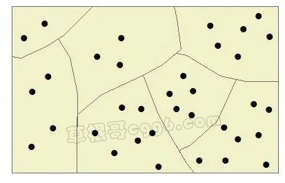
在实际工作中,有时需要统计每个行政区内的点状地物数量。假设有一个面文件(区.shp)和一个点文件(点.shp),那么如何统计面文件中每个斑块上有多少个点呢?今天,我们来介绍一下在ArcGIS中如何进行上述统计。
1. 加载文件
2. 空间关联

首先,在ArcGIS的TOC窗口中,右击区文件,选择“Joins and Relates” –> “Join”,打开“Join Data”对话框。

然后参照上图,在❶处选择“Join data from another layer based on spatial location”。在❷处选择需要进行统计的点文件,即“点.shp”。在❸处,选择“Each polygon will be given a summary of the numeric attributes of the points that fall inside it, and a count field showing how many points fass inside it.”。在❹处,设置好输出文件的位置和名称。最后点击“OK”按钮即可。

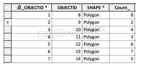
3. 查看统计结果
本文来自投稿,不代表本站立场,如若转载,请注明出处:
